Good Migrations – HMS Update
Jenny Suter
The 2021 Reporting Cycle
It is that time again! Prior to mid-March each year, HMS analysts and data managers on the West Coast and Pacific Islands are busy reviewing logbook, observer, sampling, and landings data prior to the annual data freeze and reporting cycle. On the West Coast, SWFSC, WCR, PacFIN, and CDFW work jointly to scrutinize and correctly categorize the landings by HMS fishery. Once the data are clean, a snapshot of the data forms the basis for reports to the Pacific Marine Fisheries Council HMS SAFE report, a suite of HMS PacFIN Apex reports, and international data submissions from the U.S. for the Western and Central Pacific Marine Fisheries Commission (WCPFC), Inter-American Tropical Tuna Commission (IATTC), International Scientific Committee for Tuna and Tuna-like Species in the North Pacific Ocean (ISC), and for the United States – Canada Albacore Treaty. Similarly, a suite of comprehensives is generated from the logbook and sampling data, which also feeds into the aforementioned international reports and for stock assessments.
Highly Migratory Species Professional Specialty Group
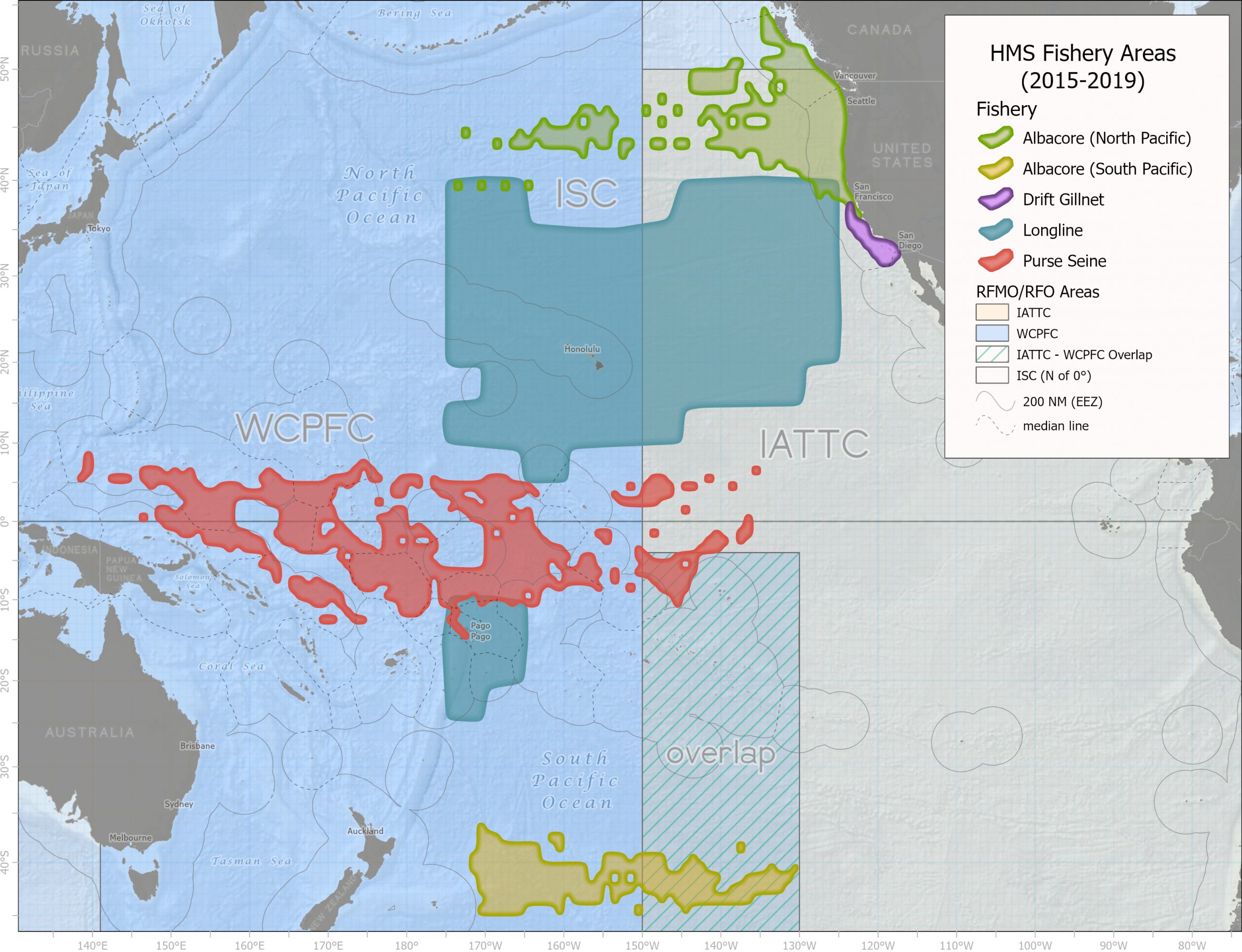
PacFIN is the agreed-on data hub for Highly Migratory Species (HMS) PSG. After the successful automation of the WCPFC annual report in 2020, the PSMFC GIS team created a map of the Pacific HMS fisheries based on these summarized datasets that helps communicate the extent of the individual fisheries and their international management areas. The GIS team also created visualizations of the changes in fisheries overtime. The map already has multiple uses in presentations and regulatory documents. The team is working on creating maps for the harpoon, buoy gear, hook-and-line, and recreational fisheries that occur off of the California coast and for the handline and tropical troll fisheries around the Hawaiian Islands, Guam, Commonwealth of the Mariana Islands, and American Samoa that are challenging to see at this scale.